
It stretches just 2.4 miles, from the foot of the Ravenel Bridge to the intersection of Ben Sawyer and Chuck Dawley boulevards, but the story of what is now Coleman Boulevard reaches back to the earliest days of Colonial Charles Town.
Georgetown Road was the main thoroughfare in Christ Church Parish when Robert Mills surveyed the area in 1825. It followed an old Native American route that once brought tribes to the coast to enjoy the ocean’s bounty of shellfish. These old “Indian” pathways become the roads of the early colonists. King’s Highway was established as early as 1650, when King Charles II instructed the Colonial governors to build postal routes linking the Colonies.
Following the American Revolution¸ newly-elected President George Washington traveled to Charleston on King’s Highway during his Southern Tour. He arrived in the city on a barge he boarded at Shem Creek. After his visit, memorialized in a painting by John Trumbull that now hangs in Charleston’s City Hall, colonists often referred to the road as Washington’s Highway.
President James Monroe also visited Charleston, accompanied by his Secretary of War John C. Calhoun, a South Carolina native.
In the late 1800s, many Charlestonians summered at Sullivan’s Island. Barges and ferries brought city residents to the wharf on Hibben Street in Mount Pleasant. From there, they boarded trolleys that traveled down Pitt Street, across the Cove Inlet Bridge to the island. Another line, the Cooper River Ferry, landed at Hog Island – today Patriots Point – and dropped off passengers for a trolley which followed old Georgetown Road into the village of Mount Pleasant, where it continued to Sullivan’s Island.
When the federal government established the Ocean Highway early in the 20th century, the route followed much of Old Georgetown Road and King’s Highway. In South Carolina, it was known as Route 40. When the ‘motor car’ arrived, improvements such as paved surfaces became necessary.
The opening of the first Cooper River Bridge in 1929 – a private enterprise financed by the owners of Isle of Palms, who wanted to bring tourists from Charleston to their island resort – brought many changes to Mount Pleasant. The bridge deposited tourists onto Old Georgetown Road, where a toll booth was located. The bridge offered a shortcut along the coast, since Highway 17 now crossed the Charleston peninsula to the bridge and linked up with Route 40. Previously, Highway 17 turned inland at the Ashley River.
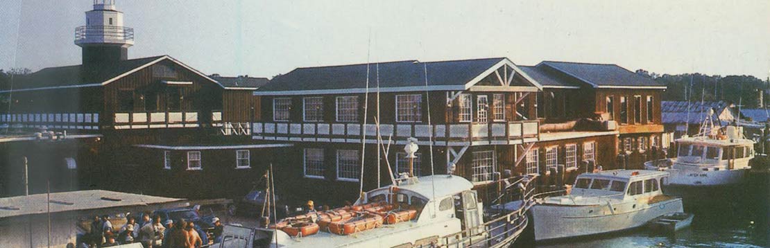
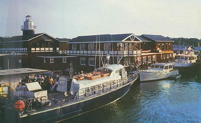
The Great Depression slowed progress in the Charleston area, and it was not until the prosperity following World War II that Mount Pleasant experienced a growth spurt. Soon businesses and motels popped up along Highway 17 as it passed through Mount Pleasant. Shem Creek, once the site of water-powered mills, became a haven for fishing boats and shrimpers, and the lure of fresh seafood attracted tourists and locals to the restaurants on its banks.
Mount Pleasant grew, annexing land in old Christ Church Parish and building roads that brandished the names of town leaders. Old Georgetown Road received a new name in 1958: Coleman Boulevard, after Mayor Francis Coleman, who served the town from 1946 until 1960. The roadway was increased from a two-lane, 18-foot-wide road to four lanes, ranging from 52 feet to 62 feet wide before connecting to the fork leading to Sullivan’s Island.
A second bridge opened in 1967 that connected to a new Highway17 bypass, built through the former tomato and okra fields. The highway drew travelers away from Coleman Boulevard businesses, and Hurricane Hugo in 1989 proved to be the final death knell for many Coleman Boulevard businesses.
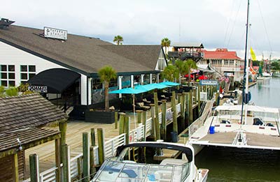
In the early 1990s, plans were launched to revitalize Coleman Boulevard. A newer plan continues to transform the boulevard into Mount Pleasant’s main street.